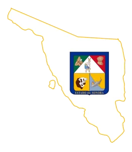
Geographical position and Climate of Sonora
Sonora is located in the northwestern region of Mexico, sharing a border with the United States to the north, specifically with the states of Arizona and New Mexico. To the east, it borders the Mexican state of Chihuahua; to the south, it borders Sinaloa; and to the west, it has a long coastline along the Gulf of California (Sea of Cortez). The state’s geography is diverse, featuring mountain ranges such as the Sierra Madre Occidental, vast deserts, and fertile valleys.
The climate in Sonora varies significantly from arid to subtropical, depending on the area:
- Desert Regions: Much of Sonora is desert, and these areas experience extremely hot summers with temperatures often exceeding 40°C (104°F), while winters are mild to cool. Rainfall is scarce, and most of it occurs during the monsoon season in the summer months.
- Coastal Areas: Along the Gulf of California, the climate is milder compared to the inland desert areas. Summers are hot and humid, while winters are warm and more comfortable. The proximity to the sea moderates the temperature swings.
- Mountainous Areas: In the higher elevations of the Sierra Madre Occidental, the climate is cooler and can receive more rainfall. Temperatures here are more temperate year-round, with colder winters that can include snowfall at the highest altitudes.
Overall, Sonora’s geographical position results in a climate that is predominantly arid and hot, with significant variations based on altitude and proximity to the coast. Visitors should plan their activities accordingly, taking into account the regional climate patterns and seasonal changes.
Best time to visit Sonora
The best time to visit Sonora largely depends on the activities you’re interested in and your tolerance for heat. Here’s a seasonal guide to help you plan your trip:
Fall (October to November)
- Pleasant Weather: Temperatures begin to cool down, making outdoor activities more enjoyable.
- Cultural Events: Experience local traditions such as Día de Muertos (Day of the Dead) celebrations.
Winter (December to February)
- Mild Climate: Ideal for exploring the desert and coastal regions without the extreme heat of summer.
- Whale Watching: This is the beginning of the whale-watching season along the Gulf of California, where you can see these majestic creatures up close.
Spring (March to May)
- Nature in Bloom: The desert landscape comes alive with wildflowers, especially after a wet winter.
- Outdoor Activities: Comfortable temperatures for hiking, bird watching, and visiting natural attractions before the summer heat sets in.
Summer (June to September)
- Very Hot: Desert areas can be extremely hot; however, this is a good time to visit the higher elevations or coastal areas where it’s cooler.
- Monsoon Season: Brings rain and relief from the heat, but also higher humidity and potential for flash floods.
Specific Recommendations
- Beachgoers: If you’re looking to enjoy the beaches of Sonora, late fall through spring offers the most comfortable weather.
- Desert Explorers: Plan your visit during the winter months when daytime temperatures are milder.
- Avoiding the Heat: If you’re sensitive to high temperatures, avoid traveling in the peak of summer, especially to inland and desert areas.
Overall, the best time to visit Sonora for most travelers is during the fall and winter months when the weather is cooler and more conducive to a variety of activities. However, if you don’t mind the heat or are interested in specific summer events or activities, there are still plenty of reasons to visit during the warmer months.
Travel to Sonora
Sonora is accessible by various modes of transportation, depending on your starting point and preferences. Here’s how you can get to this Mexican state:
By Air
- Hermosillo International Airport (General Ignacio Pesqueira García International Airport – HMO): The main airport in Sonora, located near the capital city, Hermosillo. It offers domestic flights from major cities in Mexico and some international flights from the United States.
- Ciudad Obregón International Airport (CEN): Another option for travelers, serving the southern part of Sonora with domestic flights and limited international service.
With Car
- Driving from the U.S.: Sonora shares a border with Arizona, making it easily accessible by car. Key border crossings include Nogales, Agua Prieta, and San Luis Río Colorado. Highways are generally well-maintained, especially the major routes like Highway 15, which runs from the border down through Sonora to Sinaloa.
By Bus
- Long-Distance Buses: Mexico has an extensive network of long-distance buses. From the United States, you can take buses that cross the border into Sonora. Within Mexico, numerous bus lines operate services to various cities in Sonora from other parts of the country.
By Train
- El Chepe: While not a direct route into Sonora, the famous “El Chepe” train travels through the Copper Canyon and ends in Los Mochis, Sinaloa, which is adjacent to southern Sonora. Travelers can explore the canyon and then enter Sonora by road.
Tips for Travelers
- Travel Documents: Ensure you have the necessary travel documents, such as a passport and tourist visa (if required).
- Car Insurance: If driving, make sure you have valid car insurance that covers you in Mexico.
- Road Safety: Be aware of local driving laws and road conditions, and avoid driving at night when visibility and safety can be reduced.
- Stay Informed: Check for any travel advisories or regional updates before and during your trip.
Whether you’re flying in for a quick visit or embarking on a road trip adventure, getting to Sonora is straightforward with several convenient options available.
Places to visit in Sonora
- Hermosillo
- Guaymas
- El Pinacate y Gran Desierto de Altar Biosphere Reserve
- Bahía de Kino (Kino Bay)
- Isla Tiburón

Important Information
Capital – Hermosillo
Largest City – Hermosillo
Territory – 179,355 km2
Population – 2,944,840
Time Zone – UCT-7 (MST)
