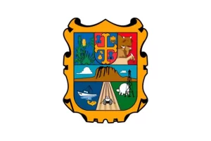
Geographical position and Climate of Tamaulipas
Tamaulipas is a state located in northeastern Mexico, bordered by the Gulf of Mexico to the east, the Mexican states of Nuevo León to the west, San Luis Potosí to the southwest, and Veracruz to the south. To the north, it shares an extensive border with the United States along the Rio Grande (Río Bravo del Norte), across from the U.S. state of Texas.
Overall, Tamaulipas experiences a range of climatic conditions, from tropical along the coast to semi-arid in the interior and northern parts of the state. It’s important for travelers to consider these variations when planning a visit to ensure they pack appropriately for the region they intend to explore.
Best time to visit Tamaulipas
The best time to visit Tamaulipas largely depends on the activities you’re interested in and the region of the state you plan to explore. Here are some general guidelines:
Coastal Areas:
- Winter (December to February): This season offers cooler temperatures and less humidity, making it ideal for beach activities and exploring coastal towns without the intense heat.
- Early Spring (March to April): The weather is still relatively mild, and you can avoid the heavy rains and hurricanes that may occur later in the year.
Inland and Mountainous Areas:
- Spring (April to June): During this period, the temperatures are warm but not excessively hot, and the landscape is often lush and green after the winter rains.
- Fall (October to November): The weather cools down, providing comfortable conditions for outdoor activities like hiking and exploring the natural scenery.
Bird Watching:
- Spring and Fall Migration Seasons: These are peak times for birdwatchers, as Tamaulipas lies on major migration routes for many bird species traveling between North and South America.
To Avoid:
- Summer (June to September): This is the hottest part of the year, with high humidity levels, especially in coastal areas. It’s also hurricane season, which can lead to unpredictable weather and potential travel disruptions.
- Late Spring (May to June): In some inland areas, these months can be particularly hot and uncomfortable for those not accustomed to high temperatures.
Regardless of when you visit, it’s always a good idea to check the local weather forecasts and be prepared for the climate of the specific regions you’ll be visiting in Tamaulipas.
Travel to Tamaulipas
Getting to Tamaulipas, Mexico, can be done through various means of transportation, depending on your starting location and preferences. Here are the common ways to reach this northeastern state:
By Air
Tamaulipas has several airports that serve domestic and international flights. The main airports in the state include:
- General Francisco Javier Mina International Airport (TAM) in Tampico, which handles flights to major cities in Mexico and some U.S. destinations.
- General Pedro Jose Mendez International Airport (CVM) in Ciudad Victoria, the capital city of Tamaulipas.
- General Servando Canales International Airport (MAM) in Matamoros.
- Abraham González International Airport (CJS) in Nuevo Laredo.
These airports offer a convenient way to enter the state, especially for long-distance travelers.
With car or bus
Tamaulipas is well-connected by road and has an extensive network of highways that make it accessible from various parts of Mexico and the United States. Key highways include:
- Federal Highway 85 which connects Nuevo Laredo to Mexico City.
- Federal Highway 101 connecting Ciudad Victoria to the United States border at Matamoros/Brownsville.
- Federal Highway 40 which runs from Reynosa to Monterrey and other parts of Mexico.
Driving across the border from Texas into Tamaulipas is a common option for visitors from the United States. Major border crossings include:
- Laredo, Texas to Nuevo Laredo, Tamaulipas
- McAllen, Texas to Reynosa, Tamaulipas
- Brownsville, Texas to Matamoros, Tamaulipas
Bus services are also available, with numerous bus lines operating cross-border routes as well as providing extensive coverage within Mexico.
By Sea
The Port of Tampico is one of the most important ports on the Gulf of Mexico and receives both commercial and passenger traffic. Although less common for tourists, arriving by sea is an option if you are traveling on a cruise or cargo ship that docks in Tampico.
When planning your trip to Tamaulipas, consider safety advisories and travel recommendations issued by your home country, as well as the current local conditions in the region. It’s also advisable to have all necessary documentation ready if you’re crossing the border, such as a valid passport and any required visas.
Places to visit in Tamaulipas

Important Information
Capital – Ciudad Victoria
Largest City – Reynosa
Territory – 80,249 km2
Population – 3,527,735
Time Zone – UTC-6 (CST)
